WP1 Geographical and geological modelling (GIS/GEO)
The aim of work package WP1 is the continuous integration of data into the digital twin. Initially, available public data from geographic information systems was integrated. A central component of WP1 is the ongoing, real-time integration of data from the ongoing exploration program of the GeoLaB infrastructure project. This includes geophysical campaigns (i.e. 2D seismic, geoelectric, and geomagnetic surveys) during the reporting period. In addition, initial information from the GLB-1 and GLB-2 research boreholes (drill paths) was integrated. An important result during the reporting period was the first version of a structural model for the Tromm area. First, a hydrological analysis was used to determine the relevant catchment area in order to define the model boundaries of the area under consideration (Weschnitz and Ulfenbach). Based on the current structural model (Hessen3D), the geometry of the model area and an initial discretization (grid) were then created.
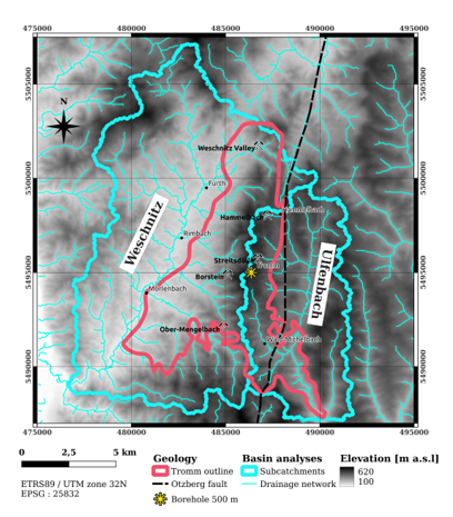 Hydrological catchment of the Tromm area |
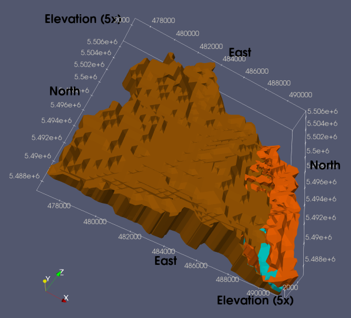 Structural model of the Tromm area |
In addition, vertical sections were laid through the model area based on the first structural model for process modeling (groundwater hydraulics) (see WP2 PCS). The current status of data integration can be seen in the following video (link, see also WP3 xVR). A current list of integrated data can be found in WP3 DMS.