Hydrological modeling and data compilation
As part of the hydrological modeling and data collection efforts at TUD, two main activities were carried out. First, based on the sub-areas delineated in the previous quarter, two 2D profiles (N-S and W-E directions) were selected for the Weschnitz and Ulfenbach sub-basins that intersect the GeoLaB-1 exploration well. The profile lines were derived from a 30 m resolution digital elevation model (DEM). For the lateral boundary conditions, a no-flow assumption is initially made, meaning that the watershed also acts as a boundary for the underground flow. The upper boundary condition is assigned a Neumann value of 176 mm/a, the average recharge rate for the crystalline and Buntsandstein-Odenwald regions according to the Hydrogeology of Hesse – Odenwald and Sprendlinger Horst (HLNUG, 2017).
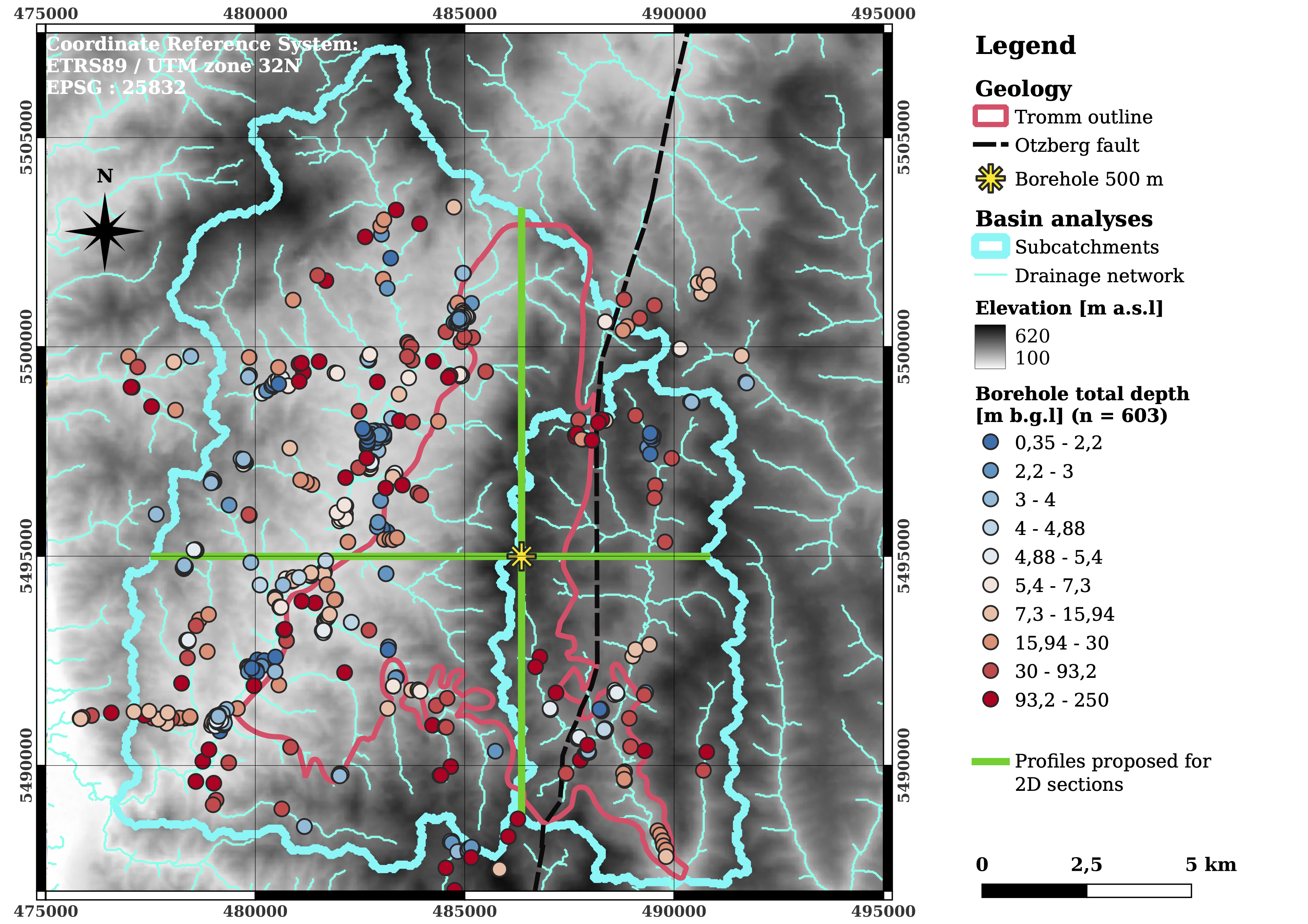
Boreholes with available logs in the subcatchments domain.
In addition, an analysis was conducted this quarter of the thickness of unconsolidated (Quaternary) deposits, including soils and alluvial and colluvial sediments overlying the rock formations. To this end, the HLNUG requested a report containing the drilling logs for 603 boreholes, which expands the existing database of 236 boreholes (see figure). Of these, 289 boreholes provide reliable data on QD thickness (i.e., the underlying rock unit). The borehole locations and depths (deciles), as well as the QD thicknesses, are presented in the figures in the report. The QD geometry is crucial for future surface hydrology modeling. An initial Kriging interpolation (spherical semivariogram, nugget = 18.9 m2) yields a rough thickness field but exhibits significant interpolation uncertainties. This result suggests that more advanced geological modeling tools, such as GemPy or Leapfrog, may be required to generate a realistic QD geometry, although preliminary tests with GemPy conducted by RTWH were unsuccessful in achieving this.